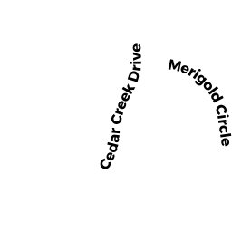
17 CEDAR CREEK DR
Owner Information
RILEY WILLIAM H & MELISSA C
17 CEDAR CREEK DR
ATTLEBORO, MA 02703


Property Details
17 CEDAR CREEK DR is classified as a Single Family Residential (Colonial).
The primary structure on this property was built in 2004. There are 5,548ft2 of built area within this property. There is 3,274ft2 of residential/living space within this property. This property is listed as having 6 rooms.
17 CEDAR CREEK DR is valued at $574,800. The land is valued at $159,900 and the structures are valued at $409,500. There is an additional valuation of $5,400 on this property.
The most recent deed for 17 CEDAR CREEK DR is recorded at the local registrar in Book 14484, Page 0226. 17 CEDAR CREEK DR was last sold on Wednesday, February 2, 2005 for $582,500.
Assessment data from fiscal year 2021.
Flood Data
According to the FEMA National Flood Hazard Layer, this property does not appear to be in a flood zone. It may also be in an area not yet reviewed. Nonetheless, confirm this information prior to taking any action.
To view the flood hazards around this property, create a FEMA "Firmette" Map of the area around 17 CEDAR CREEK DR.
Broadband Internet Providers
| Provider | Type | Bandwidth (mbps) | |
|---|---|---|---|
| GCI Communication Corp. | Satellite | 0 | 0 |
| Viasat Inc | Satellite | 100 | 3 |
| VSAT Systems, LLC. | Satellite | 2 | 1 |
| HughesNet | Satellite | 25 | 3 |
| Crown Castle Fiber | Fiber | 0 | 0 |
| Comcast | Cable | 1000 | 35 |
| T-Mobile | Fixed Wireless | 25 | 3 |
| Verizon New England Inc. | DSL | 7 | 0 |
Broadband service provider data from December 2020.
Adjacent Properties
- 21 MERIGOLD CIRCLE
Single Family Residential owned by TIMMONS LIAM M & LAUREN S - 27 MERIGOLD CIRCLE
Potentially Developable Residential Land owned by LISTRO MATTHEW P & JOANNE N - 457 LINDSEY ST
Single Family Residential owned by MOORE ALFRED E JR - 11 CEDAR CREEK DR
Single Family Residential owned by BERGSTROM CHRISTOPHER & ANGELA - 23 CEDAR CREEK DR
Single Family Residential owned by NGYUYEN LOC & HUONG GIANG